This page contains digital resources for ancient Greece and the classical Greek world.
Symbol font to Unicode Converter Utility to help with the process of converting old documents containing Greek letters to Unicode. (requires Javascript.)
Javascript keyboard for Greek A small utility to let you type in small phrases for pasting into Unicode documents.
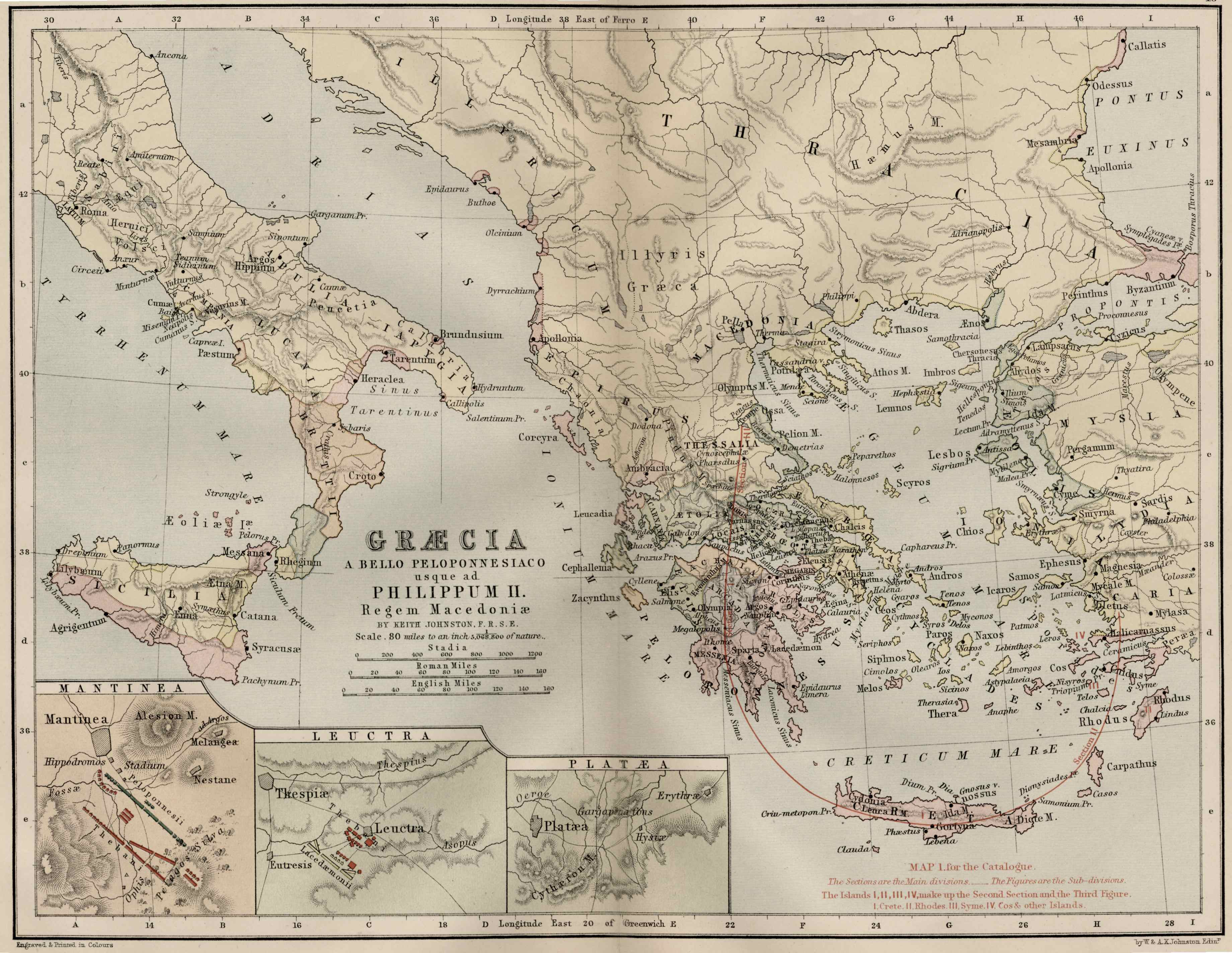
Public domain high resolution maps of ancient Greece and the ancient Greek world:
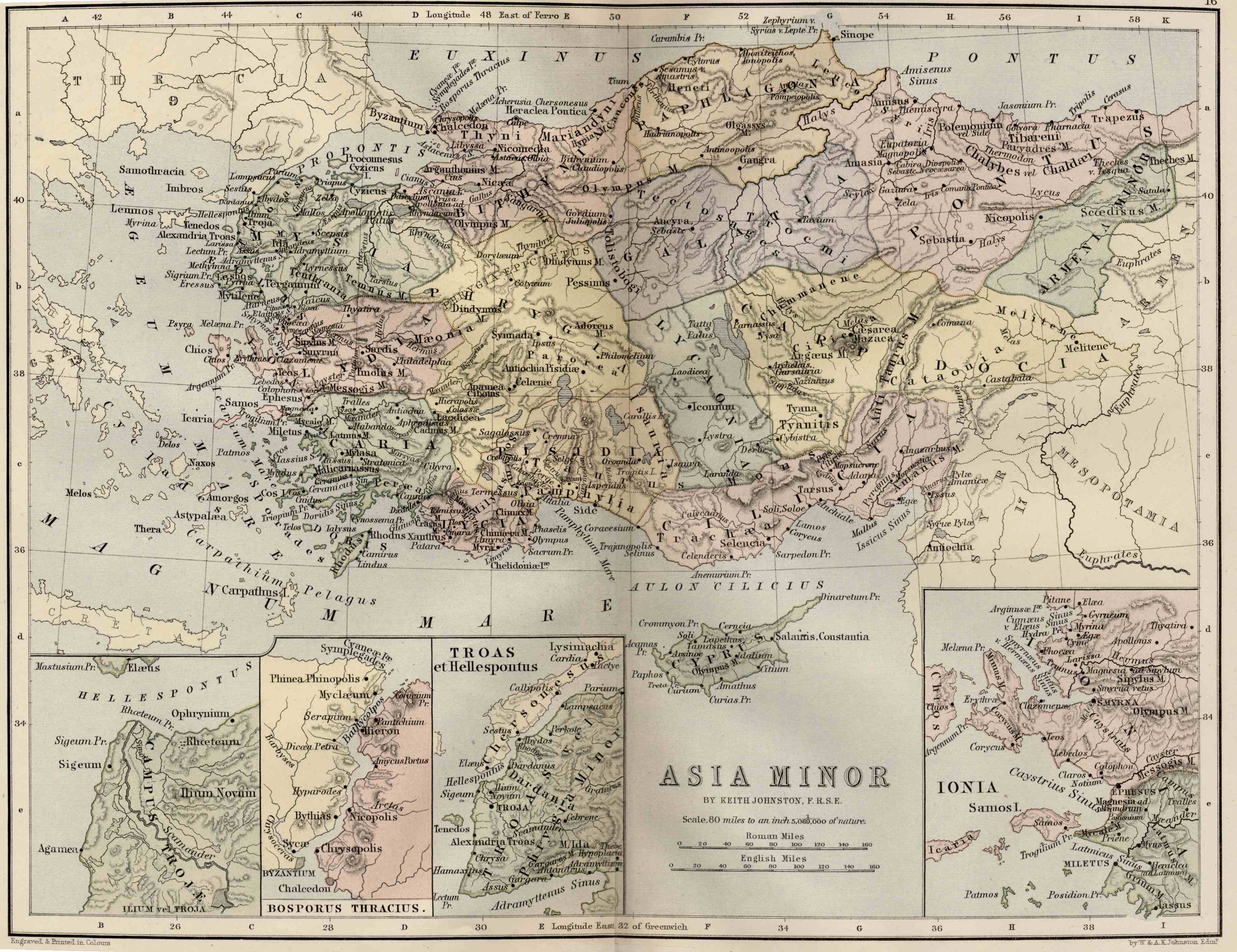
Asia Minor. Including Pontus, Cappadocia, Cilicia, Pisidia, Lycia, Caria, Lydia, Mysia, Bithynia, Paphlagonia, Phrygia, and Crete.
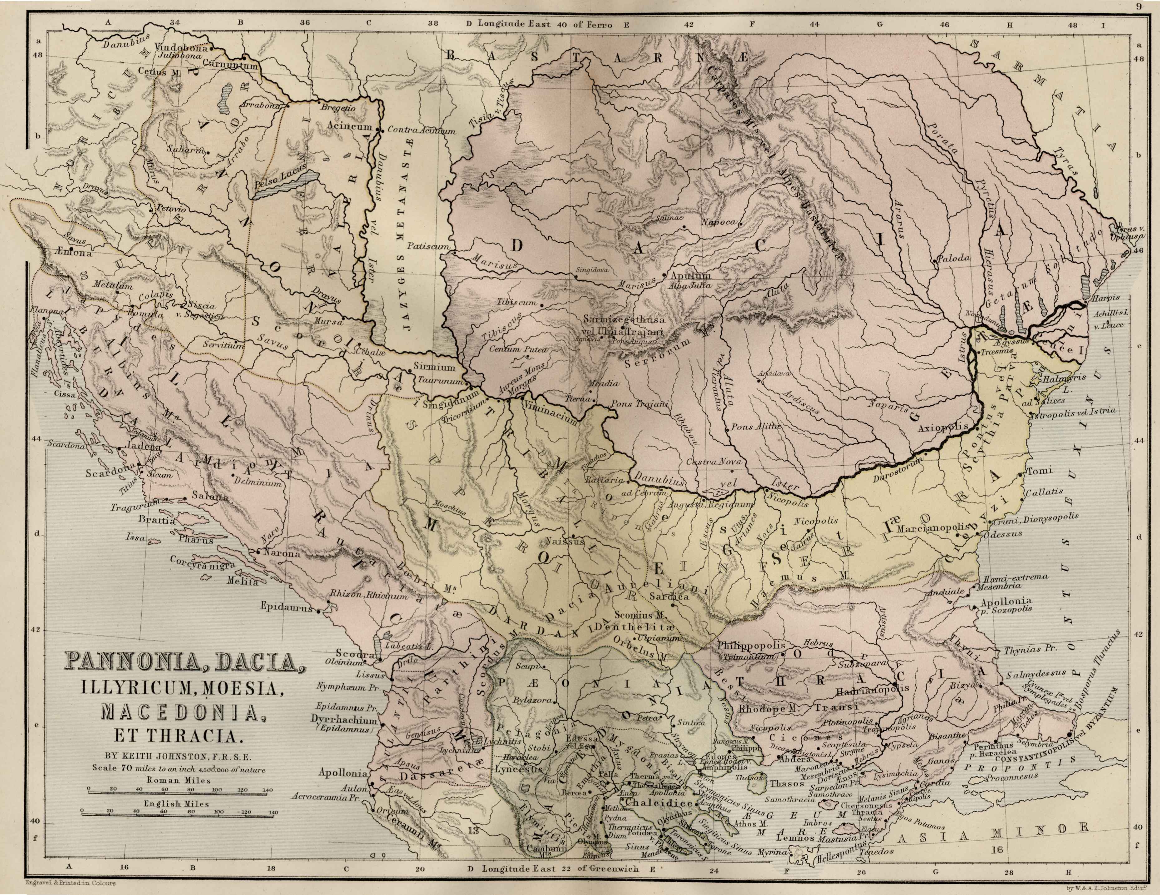
Central Europe. Including Pannonia, Dacia, Thrace, Macedon, Illyricum, Moesia.
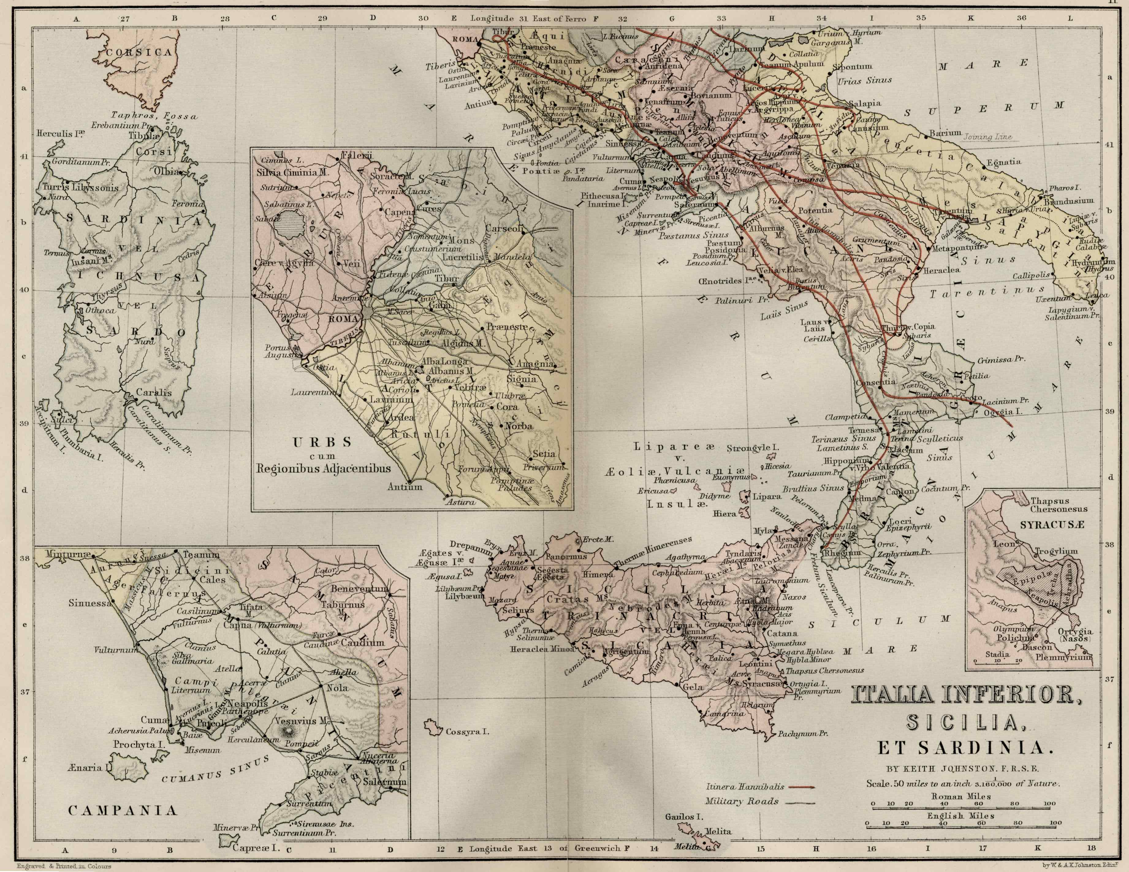
Italy and Sicily.
Greece. Attica, Euboia, Locris, Boeotia, Aitolia, Corinthia, Peloponnesos.
Each JPEG map is one megabyte in size! These color maps are 11" x 13.5" when printed at 300dpi. They were copied from an original 1886 Ginn & Company Classical Atlas designed by mapmaker Keith Johnston. These maps are completely Public Domain and can be used absolutely without restriction or even sold commercially without my permission.
(There is slight distortion caused by the age of the original and merging the scans (two scans per map) which I am working on. If I improve the maps or find cleaner ones I'll make them available here in the future.)